

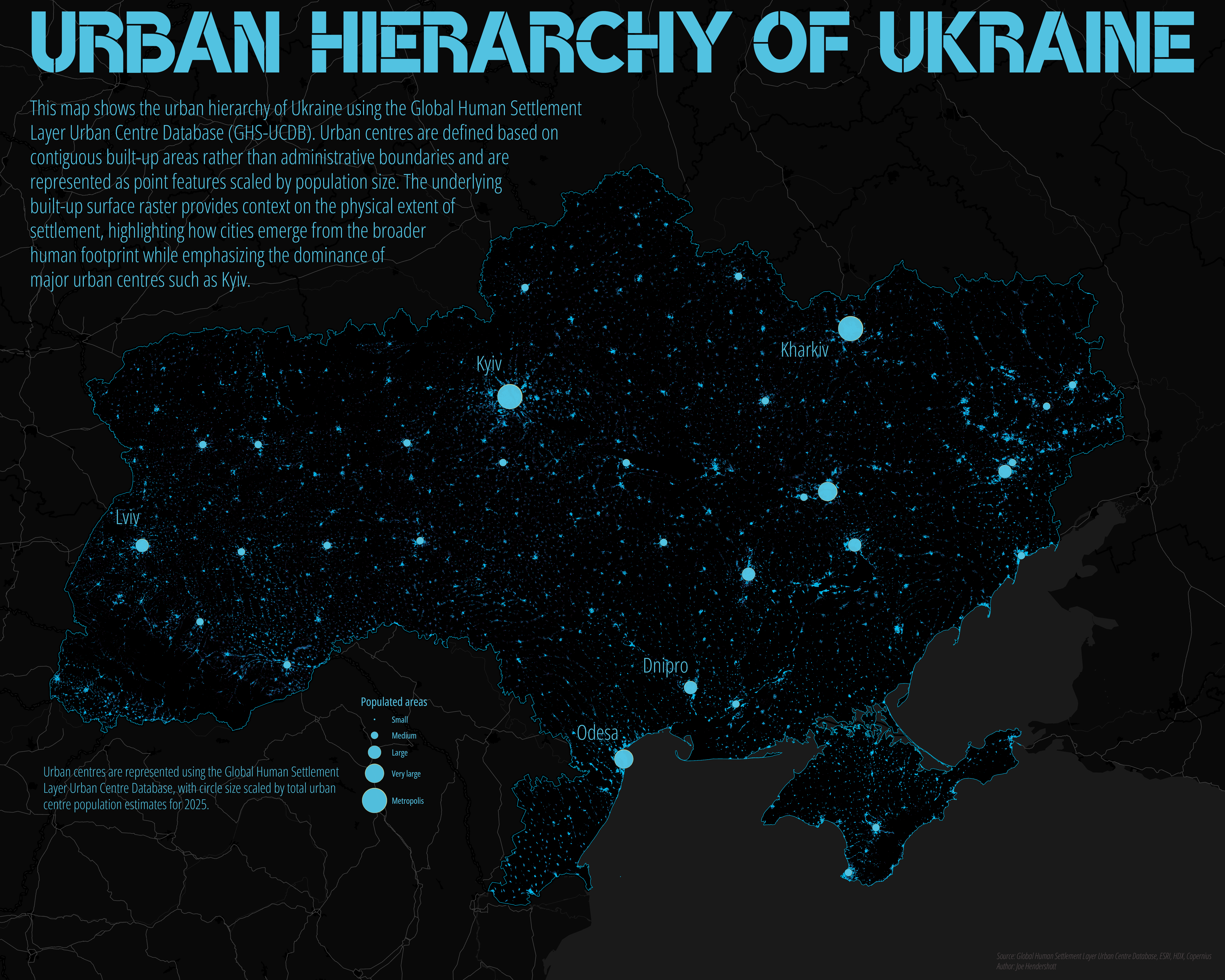
This map illustrates the urban hierarchy of Ukraine using the Global Human Settlement Layer Urban Centre Database (GHS-UCDB). Urban centres are represented as point features scaled by total estimated population for 2025, highlighting the relative dominance of major cities within the national urban system. Unlike administrative city boundaries, GHS-UCDB defines urban centres based on contiguous built-up areas detected from satellite imagery, allowing cities to be compared consistently regardless of municipal definitions or political borders. The resulting pattern emphasizes the primacy of Kyiv while also revealing secondary and regional centres such as Kharkiv, Odesa, Dnipro, and Lviv.
The underlying basemap uses the GHSL built-up surface raster, which depicts the physical footprint of human settlement rather than population density or land use classifications. This contextual layer shows how urban centres emerge from a dense but uneven settlement fabric, ranging from compact metropolitan cores to smaller regional cities embedded within widespread rural development. Together, the centroids and built-up texture provide a structural view of Ukraine’s urban system, focusing on scale and spatial organization rather than intra-urban variation. This approach supports comparative urban analysis and avoids implying precision or governance boundaries where none exist, making it well suited for regional planning, urban studies, and portfolio-level cartographic work.
Geography Joe January 12 2026Cartography, Analysis
Urban Hierarchy of Ukraine
Comments
No comments yet.