

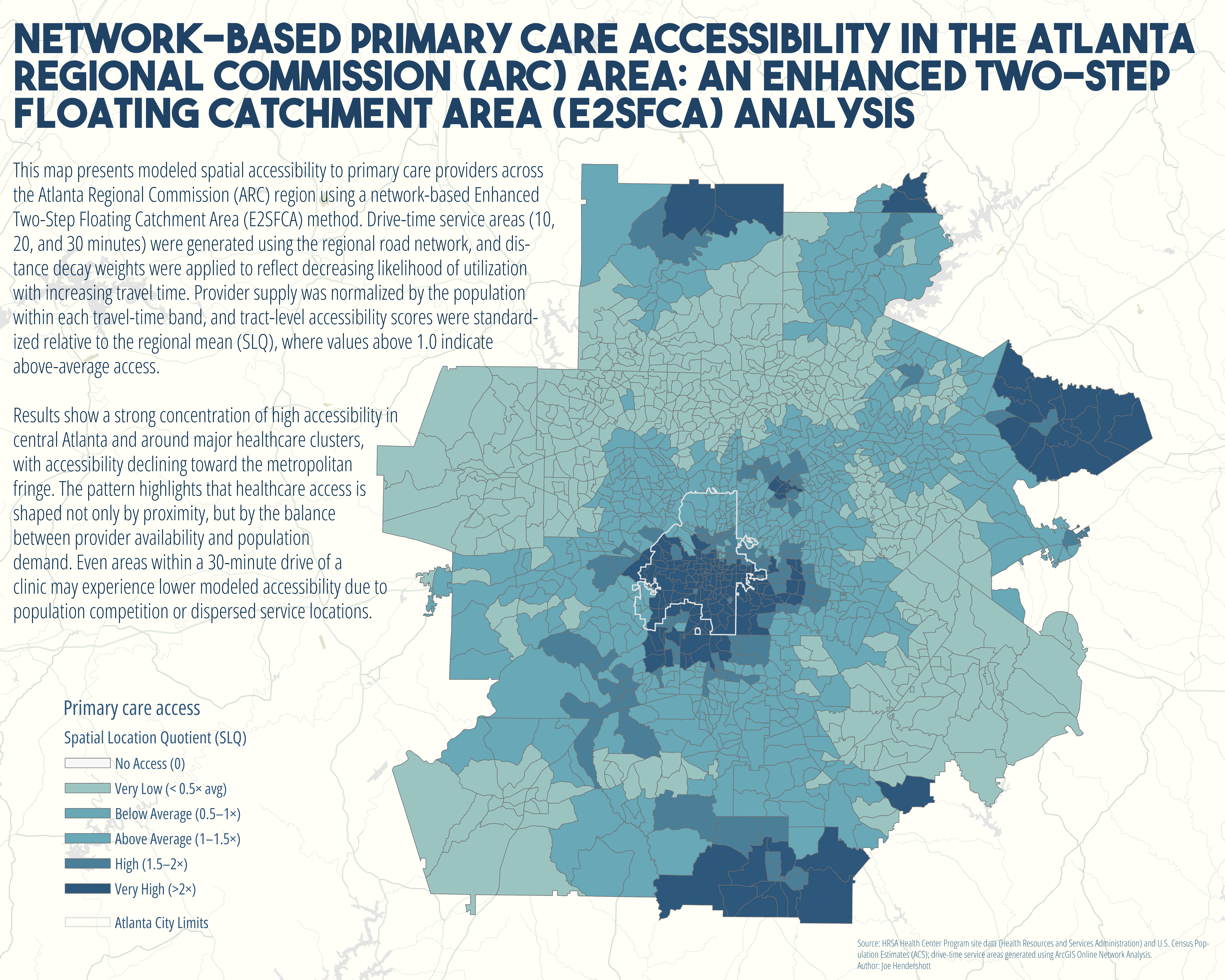
I recently completed a network-based spatial accessibility analysis of primary care providers across the Atlanta Regional Commission (ARC) region using an Enhanced Two-Step Floating Catchment Area (E2SFCA) model.
Instead of simple buffers, I used real road-network drive times (10, 20, and 30 minutes) and applied distance decay weighting to account for how utilization likelihood decreases with travel time. Accessibility was modeled as a function of both provider supply and competing population demand, then standardized relative to the regional average.
The results show a clear concentration of high accessibility in central Atlanta and around major medical clusters, with accessibility declining toward the suburban fringe. Even within a 30-minute drive shed, differences in provider density and population competition create meaningful variation in modeled access.
This approach moves beyond descriptive mapping and into quantitative spatial modeling of healthcare availability, an important step for evaluating equity, infrastructure distribution, and urban service capacity.
Geography Joe February 19 2026Cartography, Analysis, Health, Cities
Network-Based Primary Care Accessibility in Metro Atlanta
Comments
No comments yet.