

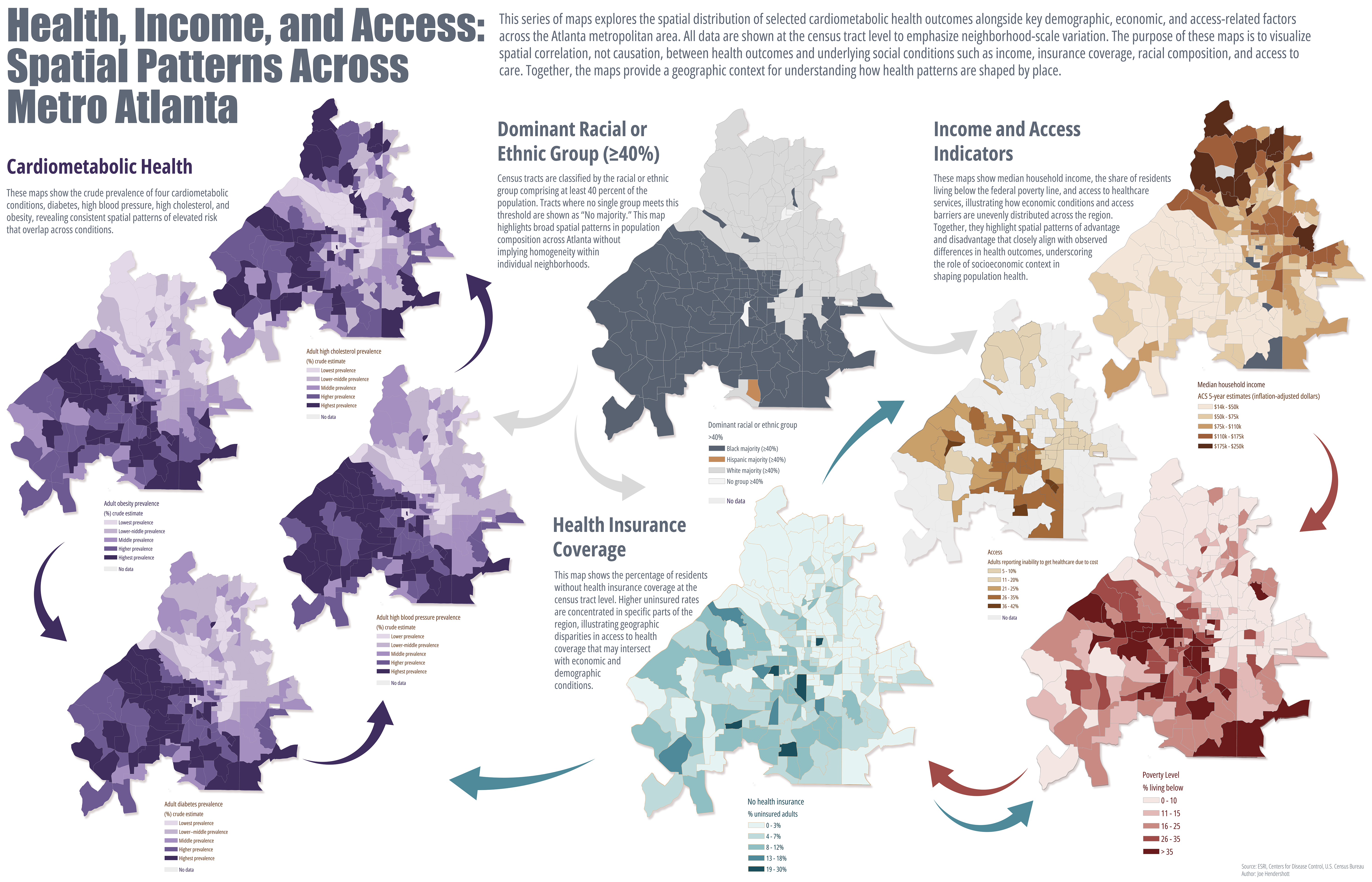
This project examines how cardiometabolic health outcomes intersect with race, income, poverty, and healthcare access across Metro Atlanta. By mapping these factors at the census tract level, the analysis highlights spatial patterns that are often obscured in tabular data, offering a place-based perspective that is directly relevant to public health practice, urban planning, and policy development. The intent is not to establish causality, but to visualize structural relationships that can inform targeted, equitable interventions.
Health outcomes were derived from the CDC PLACES dataset, which provides tract-level modeled estimates for chronic disease prevalence and risk factors. Socioeconomic, demographic, poverty, and health insurance indicators were drawn from the American Community Survey (ACS) 5-year estimates and related federal datasets. All datasets were standardized to census tracts and mapped using consistent geographic extents and classification methods to support cross-map comparison and interpretation.
Key limitations should be acknowledged. PLACES estimates are modeled and rely on survey inputs rather than clinical records, while ACS data are multi-year averages with associated margins of error, particularly at small geographic scales. Census tracts also vary in population size and internal heterogeneity. As such, these maps depict spatial correlation, not causal relationships, and should be interpreted as screening tools rather than diagnostic measures.
This matters because place-based disparities shape demand on healthcare systems, influence workforce participation, and affect long-term community resilience. Visualizing these relationships supports more strategic allocation of resources, informs prevention focused planning, and reinforces the importance of integrating health considerations into housing, transportation, and economic policy decisions.
Geography Joe December 31 2025Cartography, Analysis, Health
Spatial Patterns of Health, Income, and Access Across Atlanta
Comments
No comments yet.