

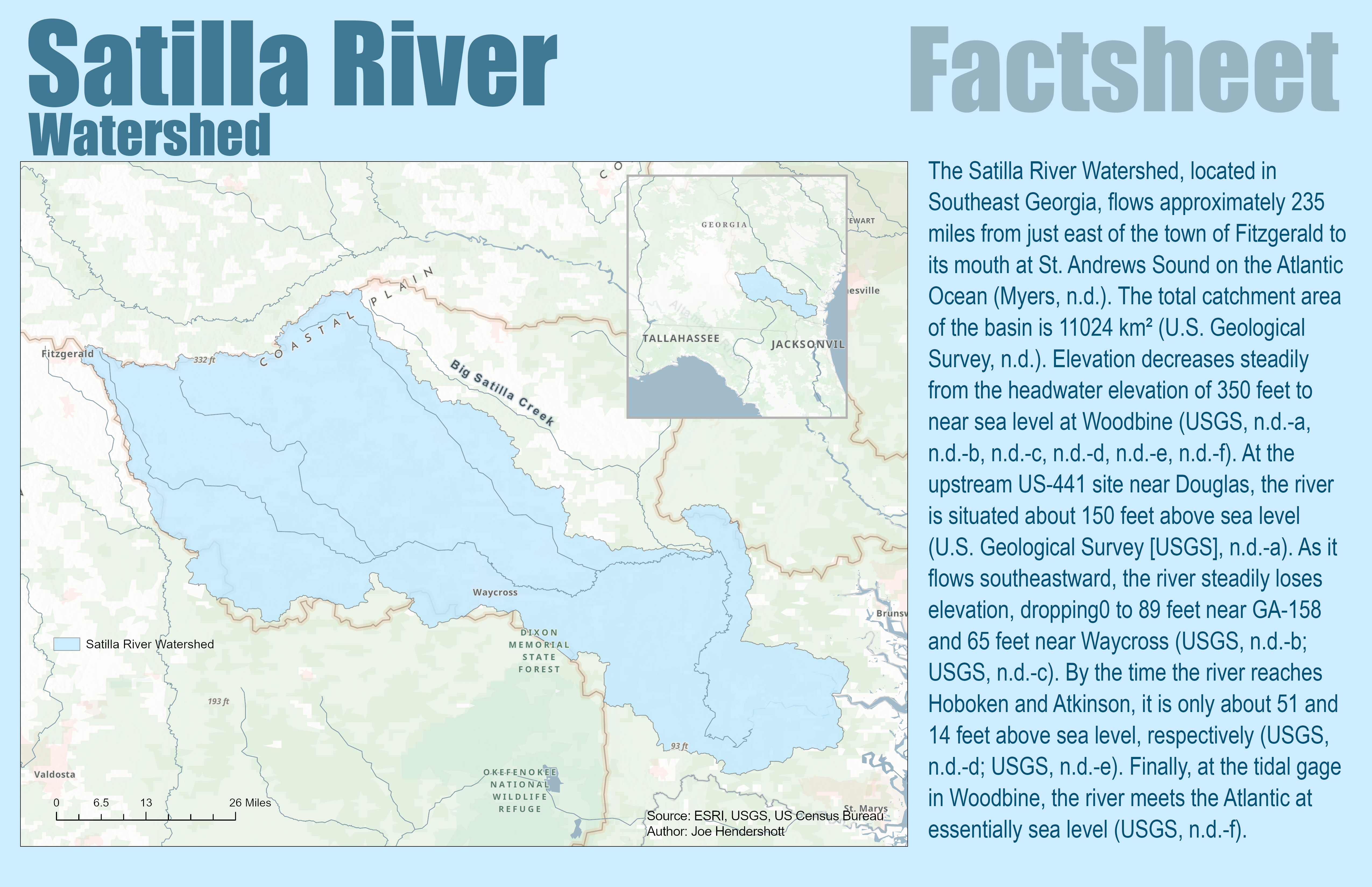
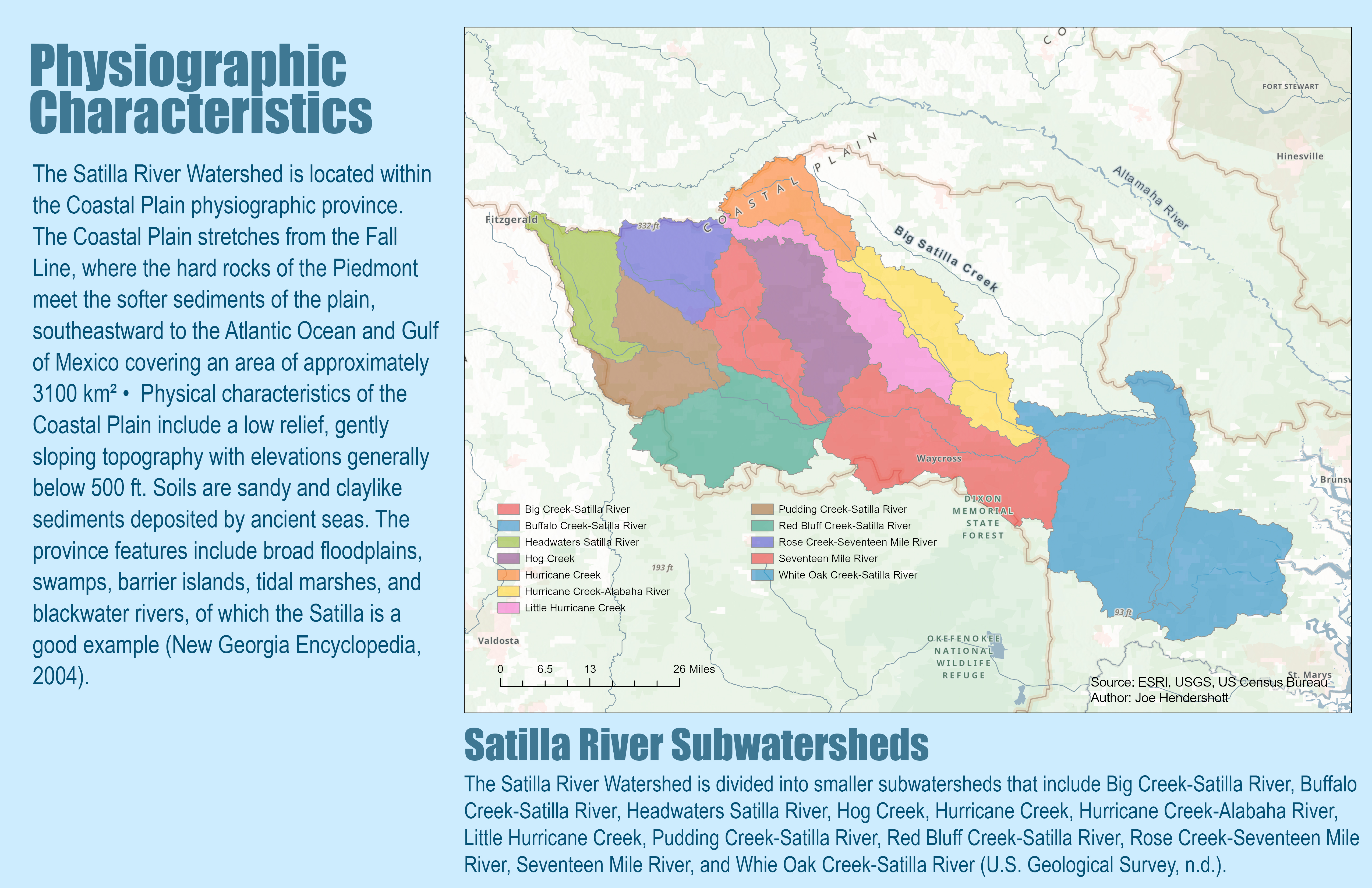
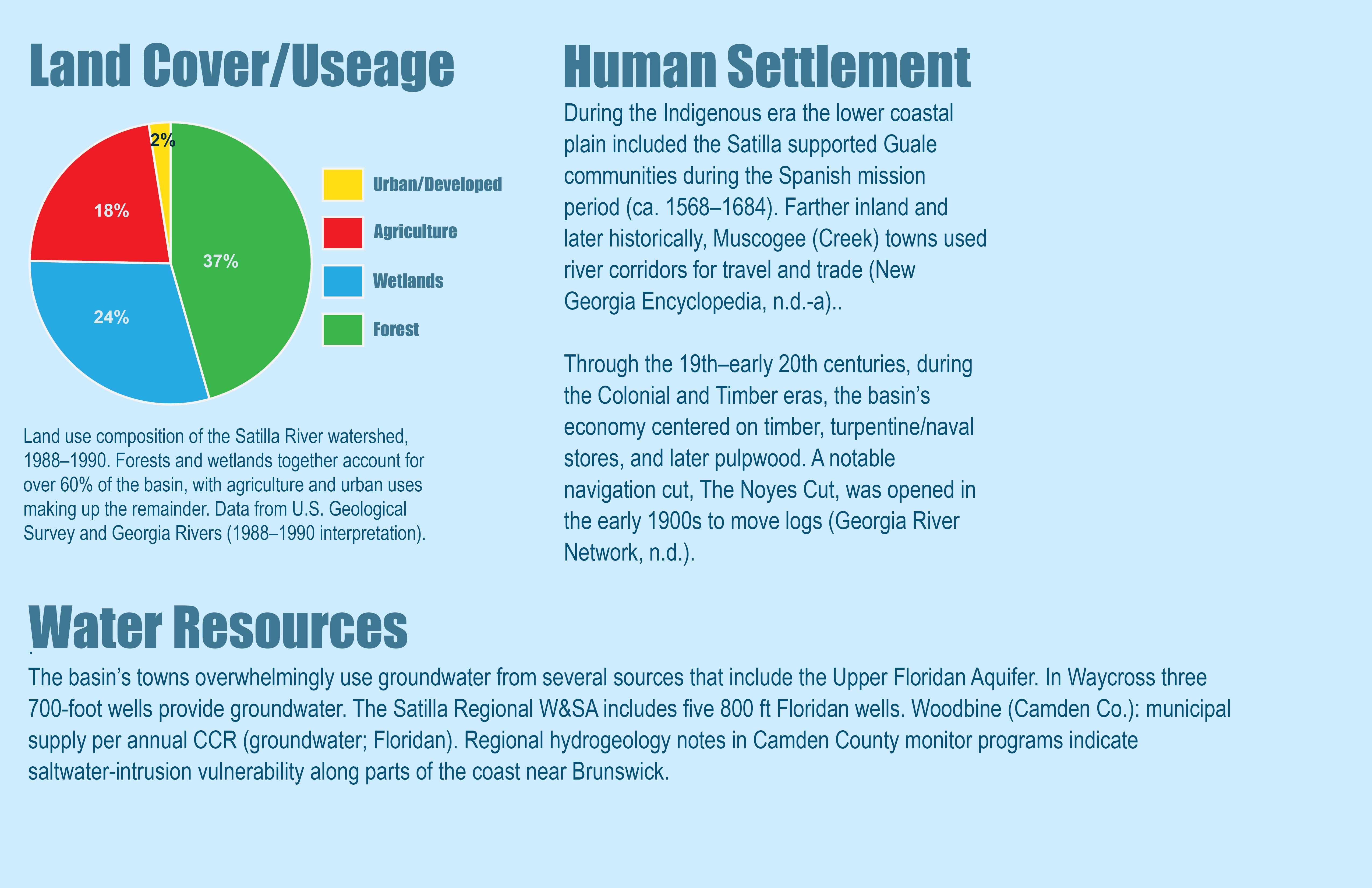
This factsheet provides an overview of the Satilla River Watershed in southeast Georgia, tracing the river from its headwaters near Fitzgerald to its mouth at St. Andrews Sound on the Atlantic coast. The Satilla River flows approximately 235 miles through a low-lying Coastal Plain landscape characterized by gentle slopes, sandy soils, wetlands, and broad floodplains. Maps and graphics show the watershed boundary, major subwatersheds, land cover, and key physical features, highlighting how elevation steadily decreases from inland areas to near sea level at the coast. Forests and wetlands dominate the basin, together making up more than 60 percent of land cover, while agriculture and limited urban development account for the remainder
The factsheet also explains how human activity and natural processes shape the Satilla River system today. Historically, the river supported Indigenous communities and later played a central role in timber, naval stores, and pulpwood industries. Today, most communities in the basin rely on groundwater from the Upper Floridan Aquifer, while land-use change, mineral extraction, and increasing development pose growing challenges. Pollution from both point sources, such as permitted discharges, and non-point sources, including agricultural runoff and septic systems, affects water quality in parts of the river. Several stream segments are impaired for bacteria, dissolved oxygen remains a concern in this blackwater system, and fish consumption advisories apply in some areas. Together, these factors highlight the Satilla River as a largely natural but vulnerable watershed where land use, water resources, and environmental health are closely interconnected
.
Comments
No comments yet.