

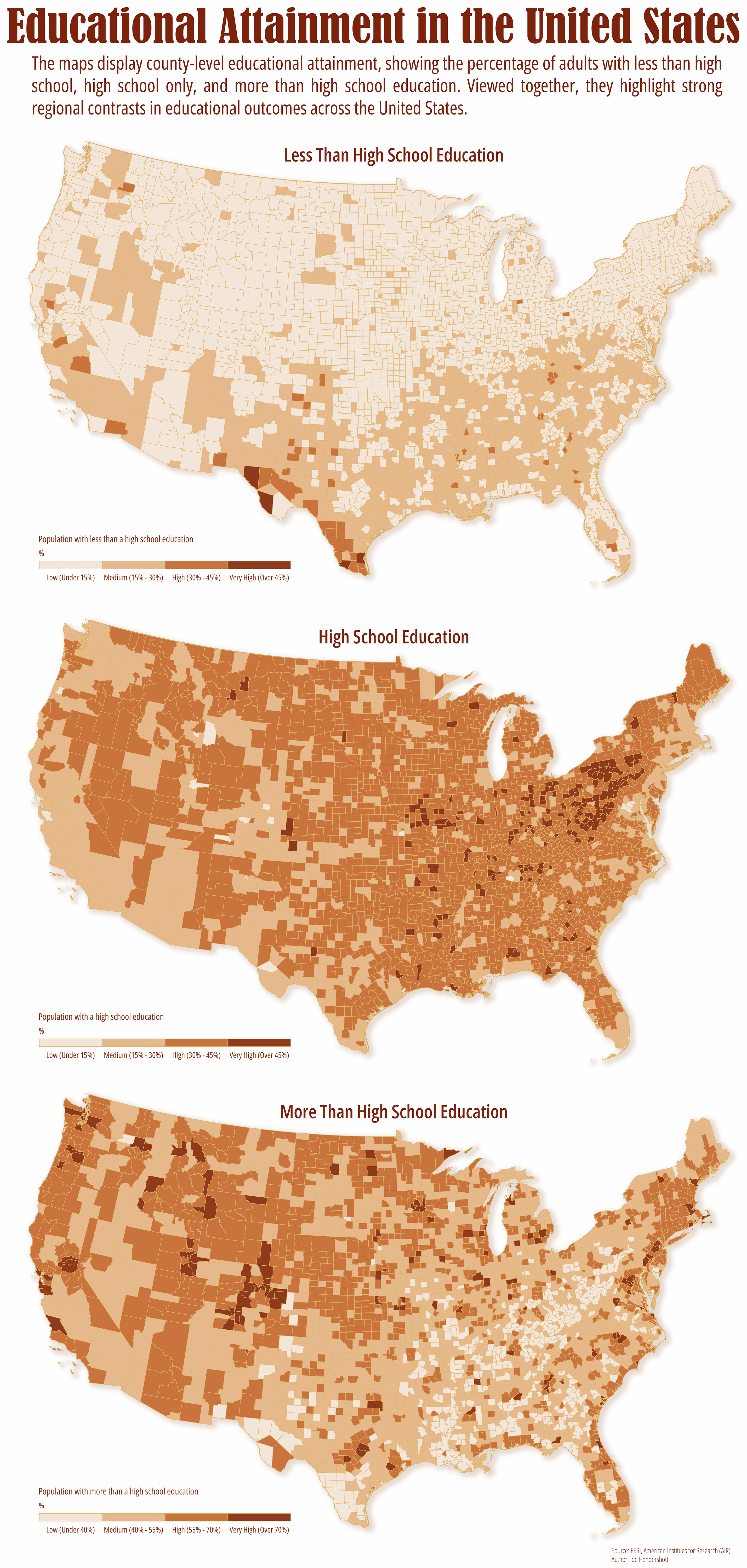
Educational attainment remains one of the strongest predictors of economic opportunity, health outcomes, and long-term regional growth. These maps, based on data from the American Institutes for Research, visualize county level patterns in educational attainment across the United States by separating adults into three groups: those with less than a high school diploma, those whose highest credential is high school, and those with education beyond high school, including college and graduate degrees.
Viewed side by side, the maps reveal how unevenly education is distributed across space. Areas with high concentrations of adults lacking a high school diploma remain clustered in parts of the South, Southwest, and rural regions, while counties with higher levels of post-secondary education are more common around major metropolitan areas, university hubs, and knowledge-based economies. The “high school only” map fills the middle ground, reflecting regions where access to post-secondary education or local labor market incentives may be more limited.
Rather than telling a single story, these maps underscore how education reflects broader structural forces, including historical investment, industrial change, access to institutions, and policy decisions. Mapping educational attainment spatially helps move the conversation beyond national averages and toward a clearer understanding of where opportunity is expanding, where it is constrained, and why place still matters.
Geography Joe January 18 2026Cartography, Analysis
Educational Attainment in the United States
Comments
No comments yet.